By Ranger W.
If you found your way to this site you would probably love to be living in southern Idaho on 100 acres that is further separated by natural terrain barriers to protect your little family homestead from all the looters and crazies. If you are reading this you are probably far more like me and somewhat tied to a less than perfect location, surrounded by unprepared people, with minimal acreage to separate you from the crazies. This article is not about encouraging you to move off the grid somewhere deep in the American Redoubt. Instead I have some advice on making the best of your location and can sum it up in one word: map. Do you have a map of your current location and all the maps that will lead you to your bug out location? I’m not referring to a Road Atlas, rather a real map that shows terrain features, elevation, and bodies of water in addition to all the roads and highways (otherwise known as natural lines of drift).
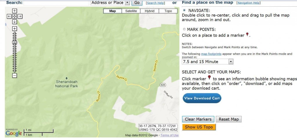
You might be thinking “that would be great but I don’t live near an Army base there aren’t any military maps of my area.” I have good news: go on over to USGS.gov. They have real terrain maps of the entire United States, which are all free for download. You can even have them printed up to the scale of your choosing and then get them laminated, but that costs extra money. Once you go to the site navigate over to the Map Locator and Downloader. Zoom in Google Maps style directly into you current location or wherever your prepper hideaway might be.
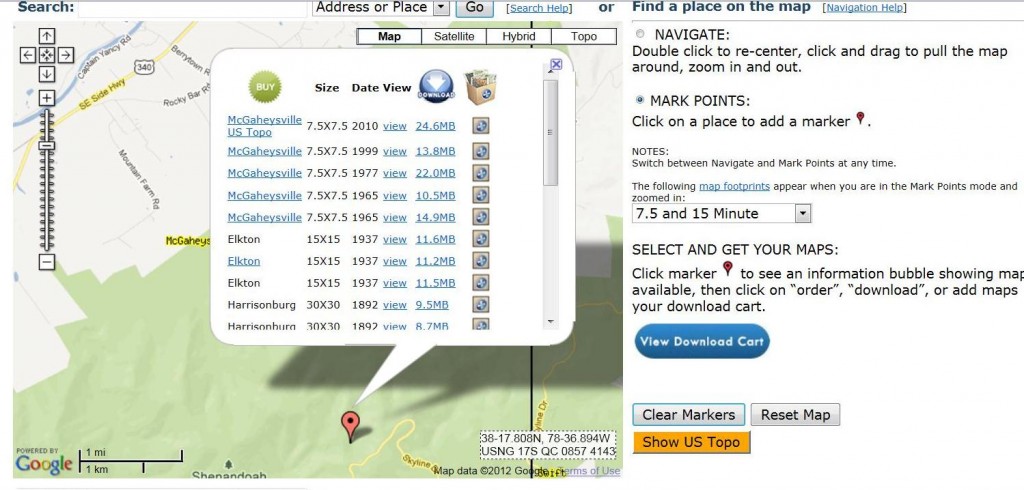
For this exercise I’ll use the Shenandoah National Park because we will need some terrain features to discuss (if this is your Bugout location I apologize for compromising its location). The next step is to click the MARK POINTS radio button. The website will do a quick reset then you will see your graphic somewhat divided into sections (the trained observer might even call these map sheets). Single click into the area you would like a map of. A reddish colored marker will drop at the location you have selected. Then single click right on that marker and a list of map sets will pop up. It will look like this:
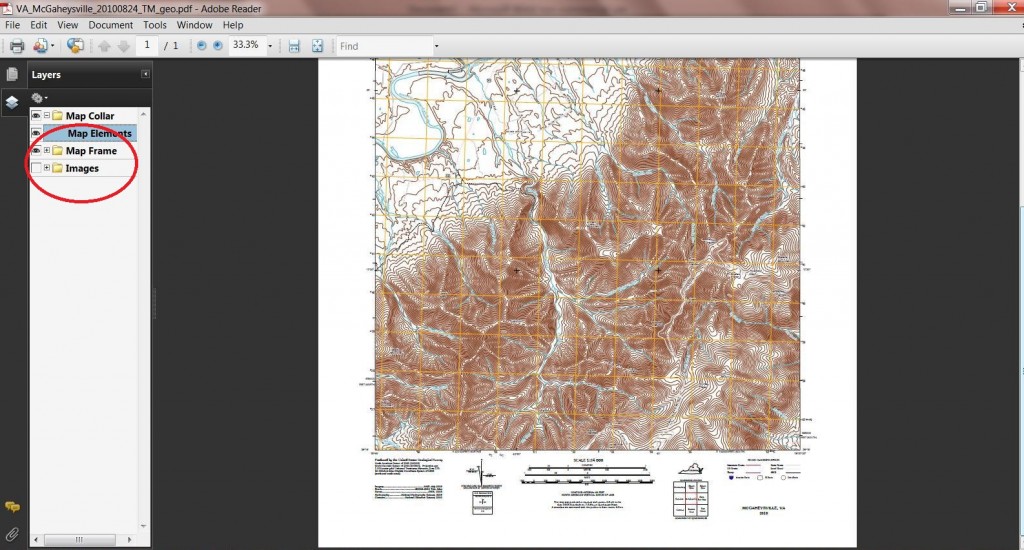
The call out box sorts the map sets from most recent to oldest. While the 1937 version might be entertaining and nostalgic your purposes will generally be better served by the newest set on the site. So find the map set you want and click the 24.6 MB hyperlink (or whatever size your map set is) and open or save your new free map! You are now the proud owner of an Adobe .pdf map detailing your chosen location. Once you open it you will see a few layers along the left side. You probably have a hybrid map with a mix between traditional map and satellite imagery. The imagery is a great addition but if you click the little eye on the left of IMAGES then you can turn that layer off and you should have a traditional military style map in front of you.
So, now that you have a map of the area you need start marking the information you will need. Even if you live in a suburb of Dallas there are terrain features you will want to know about. Where are your 3 closest water sources? Where are the natural terrain barriers you can use to deter unwanted company? I have a longstanding theory that hungry, tired, dirty, looter crazies are not going to walk uphill for long looking for food. This is why Ranger patrols always try to stay off “natural lines of drift”. Avoid directions of travel that would be easy. Hopefully this little tutorial helps you start your navigation skills on your own small square of earth. My next article will be about how to read your new found map! In the meantime, if you need to brush up on your old Boy Scout map reading check out the US Army map reading manual at this link.
Ranger W. is a frequent contributor to Prepper-Resources.com. Read some more of his works here, here and here. He attended Ranger school and graduated in class 10 of 20XX.


1 ping
[…] maps. As I mentioned in a previous article, obtain MAPS THAT SHOW TERRAIN FEATURES! Regardless what map you will be using to bug out or just […]